

Network Maps
View maps of the Iarnród Éireann Irish Rail network to help you plan your journey.
Intercity Map
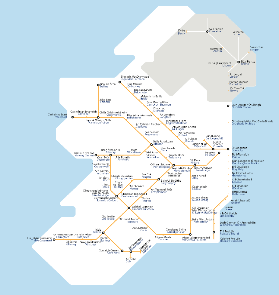
For an accessible version of our InterCity Route Map, please click on the link below:
Accessible version of InterCity Route Map
Dublin Area and Short Hop Zone Train and Tram Map
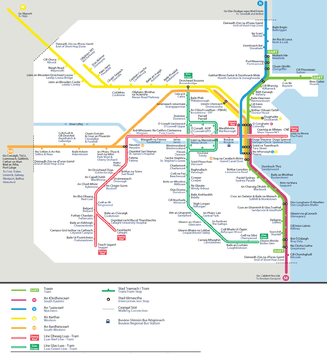
For an accessible version of our Dublin Area and Short Hop Zone Train and Tram Map, please click on the link below:
Accessible version of our Dublin Area and Short Hop Zone Train and Tram Map
Commuter Map for Dublin, Dundalk, Longford, Portlaoise

For an accessible version of our Commuter Map for Dublin, Dundalk, Longford, Portlaoise, please click on the link below:
Accessible version of Commuter Map for Dublin, Dundalk, Longford, Portlaoise
Cork Commuter Map

For an accessible version of our our Cork Commuter Map, please click on the link below:
Accessible version of Cork Commuter Map
For more information on the Iarnród Éireann Irish Rail network, please see below.
Station and Route Maps